
Three day tour from New York City to Boston covering 253 miles.
Day 1: NYC to Stamford, CT (40 miles)
We boarded an early Amtrak train from Boston and brought our bikes with us. Loading the bikes into the train wasn't the most straightforward but you're basically looking for cars that have a bike friendly emblem on the side of the train. The reality is every train car has a bike rack but the conductors prefer that you use the ones that are labeled bike friendly.
The bike rack on the train is just the luggage rack at the end of the car. If there is luggage on the rack, you might need to ask a conductor to help you move the luggage so it can be folded up to expose the bike rack. The front wheel must come off, otherwise your bike might not fit.
Getting off the train is equally as annoying as you need to wait for all other passengers to get off before you can unstrap your bike from the rack. There isn't much stopping time so you're rushing to get your bike off the train before it needs to depart.
We went to visit a friend in NYC so I didn't record until we were on our way to Stamford, CT. Normal city riding until you leave the Bronx.
Mainly followed the East Coast Greenway (ECG) which is almost all street riding. The only sections that were separated were Pelham Parkway and Shore Road.
There was very little elevation in this segment.
Day 2: Stamford, CT to East Hampton, CT (90 miles)
Followed the ECG to New Haven, CT which was almost all street riding. Most roads were quiet minus the occasional 4 lane roads without bike lanes.
Mostly flat until New Haven then elevation begins to kick in. We detoured from the RWGPS route to try to shorten the ride due to knee pain. This put us on rural roads with fast cars and wide shoulders.
After passing Middletown, the elevation really steps up with multiple 8%+ climbs to East Hampton.
Our goal was to get to the start of the Air Line Trail so we could start it first thing in the morning.
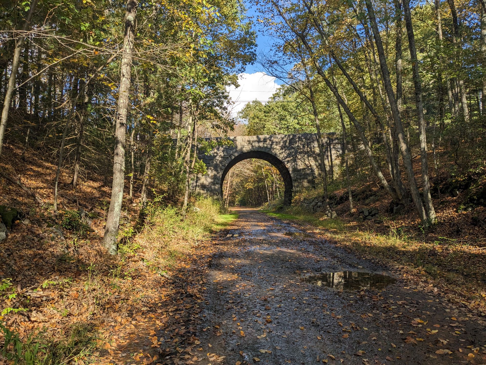
Day 3: East Hampton, CT to Boston, MA (115 miles)
The first section of the Air Line Trail from East Hampton to about Pomfret was hard packed gravel. It was easy to ride and we could maintain good pace. There were a handful of deep muddy sections which you could either walk around or slowly bike through.
After Pomfret, the trail turns into loose gravel and rough terrain. It's ride-able on a gravel bike but pace definitely suffered.
The trail is very flat, RWGPS data is incorrect.
The Air Line Trail eventually turns into the Southern New England Trunkline Trail (SNETT) which is also decently rough and bumpy, about the same as the section after Pomfret.
After leaving Douglas, MA, it turns into classic New England rolling hills all the way back to Boston. Get ready for several 5%+ extended climbs through Uxbridge, Milford, Holliston, and Needham.